Review on Applying Tier in Multi Cloud Database (MCDB) for Security and Service Availability

This review examines the application of tiered architecture in Multi Cloud Databases to enhance security and service availability. By distributing database functions across multiple cloud tiers, the approach improves fault tolerance, load balancing, and data protection. The study analyzes security mechanisms such as access control and encryption alongside availability strategies like redundancy and failover. These […]
A Noval Real-Time Map Matching Algorithm for Landmark & Uncertainty
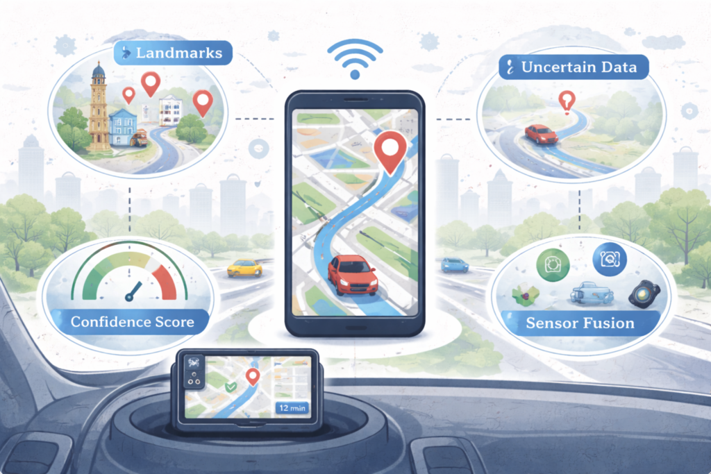
This research introduces a novel real-time map matching algorithm that improves navigation accuracy by integrating landmark information and uncertainty modeling. The approach evaluates vehicle trajectories against road networks while accounting for sensor noise and positional ambiguity. By leveraging landmarks and confidence estimation, the algorithm delivers more reliable location tracking in complex urban environments. The proposed […]
Radar Transmogrification Technology: Support for Unmanned System
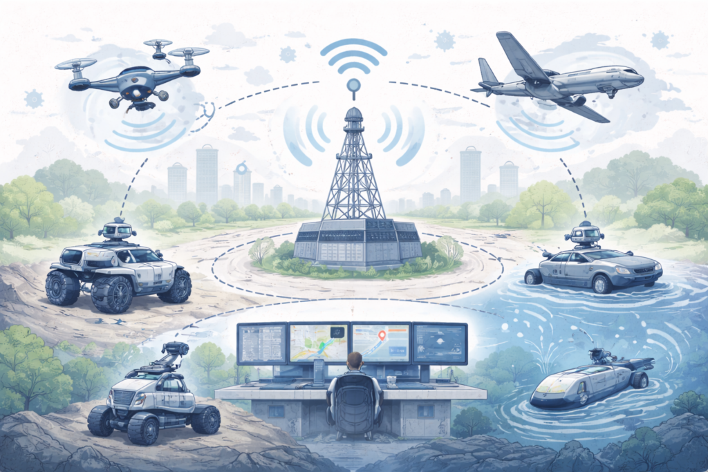
This study explores radar transmogrification technology as a support mechanism for unmanned systems operating in dynamic environments. By transforming radar signals into actionable intelligence, the approach improves detection accuracy, tracking reliability, and system coordination. The research highlights how radar-based communication enhances autonomy and situational awareness for aerial, ground, and marine unmanned platforms. These advancements strengthen […]
Inscribe the Exigency of Map Matching Performance for Curve Navigation on Road/Highways
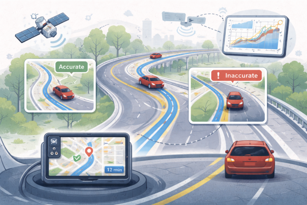
This study analyzes the importance of map matching performance for accurate navigation on curved roads and highways. By evaluating how GPS trajectories align with complex road geometries, the research highlights challenges caused by sharp curves and signal deviations. Improved map matching techniques enhance positional accuracy, route consistency, and driving safety. The findings support advanced navigation […]
Review Study of Navigation Systems for Indian Regional Navigation Satellite System (IRNSS)
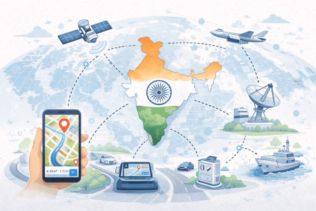
This review study examines the navigation capabilities and applications of the Indian Regional Navigation Satellite System (IRNSS). It analyzes system architecture, signal structure, and performance in providing accurate positioning and timing services across India and surrounding regions. The study highlights IRNSS applications in transportation, aviation, maritime navigation, disaster management, and defense. By offering regional autonomy […]
Map Matching Approach for Current Location Tracking on Road Network
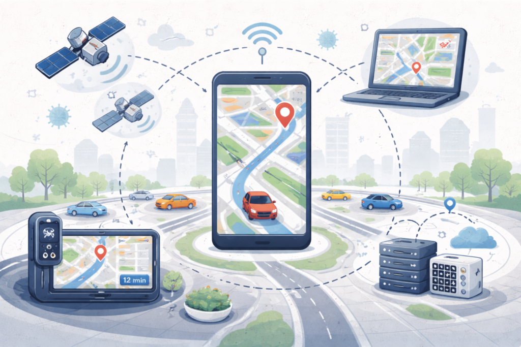
This study presents a map matching approach for accurately tracking current vehicle location on road networks. By aligning raw GPS data with digital road maps, the method minimizes positioning errors caused by signal noise or urban obstructions. The approach improves navigation accuracy, route consistency, and real-time tracking reliability. It supports intelligent transportation systems, traffic monitoring, […]
IoT for Fight Against COVID-19
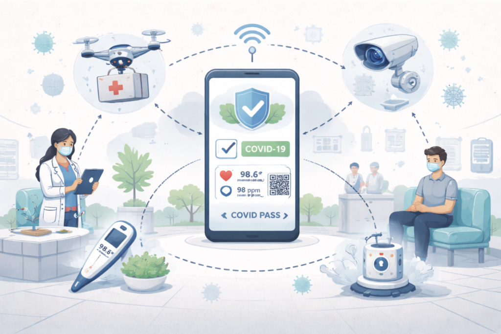
This study explores how Internet of Things (IoT) technologies support healthcare systems in combating COVID-19. By integrating wearable sensors, mobile health applications, and connected medical devices, IoT enables real-time monitoring, early detection, and efficient patient management. Automated systems such as drones and smart sanitization tools reduce human contact and improve response speed. These IoT-driven solutions […]
Alert-Based Drowsiness Detection Using Machine Learning

This research presents an alert-based drowsiness detection system that uses machine learning to analyze driver behavior in real time. By monitoring facial expressions, eye movement, and head position, the system identifies early signs of fatigue and triggers timely alerts. The approach improves driving safety by reducing the risk of accidents caused by drowsiness. The study […]
Deep Learning in Object-Oriented Software Engineering: A Case Study of Stability
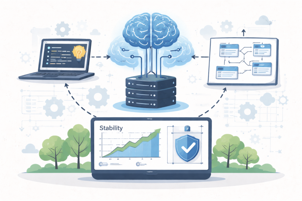
This study investigates the application of deep learning techniques in object-oriented software engineering to evaluate system stability. By analyzing object-oriented metrics, class relationships, and design structures, the model identifies patterns that influence long-term software reliability. The case study demonstrates how deep learning can improve stability prediction compared to traditional methods. These insights help developers detect […]
Data Dissemination in Vehicular Edge Network
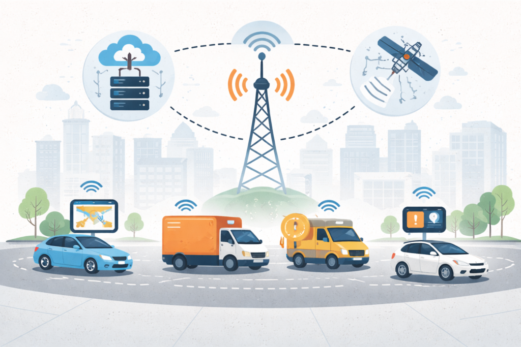
This study focuses on efficient data dissemination mechanisms within vehicular edge networks to support real-time communication among vehicles and infrastructure. By processing data closer to the network edge, the system reduces latency and improves responsiveness for safety-critical and traffic-related applications. The research examines communication strategies that enhance data reliability, scalability, and bandwidth utilization. These approaches […]